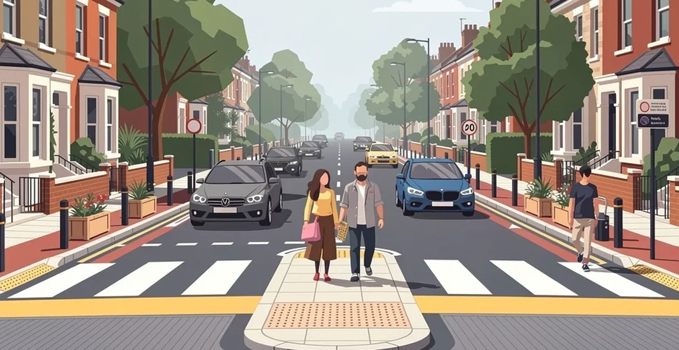
Pedestrian deaths remain one of the most persistent failures of modern road transport policy. Globally, 1.24 million people are killed in traffic crashes every year, and this figure is projected to become the fifth leading cause of death worldwide by 2030 unless current trends change. The majority of these deaths happen in and around urban areas, disproportionately affecting pedestrians and cyclists. In the United States, 2022 saw an estimated 7,508 pedestrian deaths—the highest annual total since 1981—while in Great Britain, 409 pedestrians were killed in 2024, with a further 5,823 seriously injured. This article examines what the evidence actually says about reducing these numbers, from collision data and speed physics through to specific street design interventions that have been proven to work.
Understanding pedestrian safety statistics and collision data
Effective street design starts with reliable data. Cities that have made genuine progress on pedestrian safety, such as Copenhagen, tend to be the ones with established systems for collecting and analysing crash information, then acting on it. Yet data quality varies enormously between and within countries. The World Health Organization has noted that some countries, such as Ethiopia, may record traffic deaths at levels roughly six times lower than the actual figure, while in India the underreporting factor is estimated at around double. This makes it difficult to compare cities and countries on a level footing, and it means cities with better reporting systems can appear more dangerous on paper than places with genuinely worse safety records but poorer data collection.
Vision zero frameworks and their application in urban planning
Vision Zero-style plans are built on the “safe system” approach to traffic safety, which sets clear targets and works to change the road environment itself to reduce injuries and fatalities, rather than relying solely on driver behaviour or enforcement. New York City’s Vision Zero Action Plan is a widely cited example: the city analysed pedestrian crashes across the entire urban area and targeted street design changes specifically toward the highest-risk corridors. This mirrors the approach recommended by the World Bank, which stresses that periodic monitoring and evaluation of traffic safety targets is essential and integral to a safe system approach. Copenhagen has taken a similar path with its own dedicated Traffic Safety Plan, which distinguishes between “actual safety” (recorded serious casualties) and “sense of safety” (how safe people feel), treating both as necessary measures of progress.
Analysing pedestrian fatality rates across the UK’s major cities
City-level fatality data is not consistently collected on a global scale in the way that national figures are, which makes cross-city comparisons difficult. What is clear from research into safer cities generally—including places such as Stockholm, Berlin, Hong Kong and Tokyo—is that they share common characteristics: extensive mass transport networks, good walking and cycling conditions, fewer cars travelling shorter distances, and lower vehicle speeds. These factors reduce both the exposure of pedestrians to traffic and the risk of a crash proving fatal when it does occur. Fewer vehicle miles travelled, combined with strong support for mass transport, walking and cycling, is consistently associated with fewer road fatalities.
The role of speed in pedestrian injury severity: the solomon curve
Vehicle speed is the single clearest predictor of whether a pedestrian struck by a car will survive. Research published by the OECD demonstrates a strong relationship between pedestrian fatalities and the impact speed of the vehicle involved: the faster a car is travelling on impact, the more likely the pedestrian is to die. Later studies have found slightly lower risks in the 40–50 km/h range once sample bias is accounted for, but the fundamental relationship holds. Crucially, there is clear evidence supporting policies that lower vehicle speeds to 30 km/h in areas where pedestrians are commonly present, and no more than 50 km/h on streets without grade separation. A driver travelling faster also has less time and distance in which to react and stop, which is why long, uninterrupted street blocks that encourage acceleration are consistently linked to higher pedestrian death and injury rates than shorter blocks with frequent junctions.
Identifying High-Risk junctions through collision mapping
Heat mapping of crash locations allows cities to identify specific corridors or neighbourhoods that require targeted design, enforcement, or other interventions. In Turkey, this kind of mapping software has been used to identify street corridors for treatment, addressing issues such as pedestrian or bicycle-specific crash clusters and problem areas around schools. EMBARQ Turkey used this approach to help five municipalities identify “black spots”—also called hot spots or high-crash locations—and recommend traffic calming and design changes based on formal road safety inspections. A road safety inspection (RSI) is a qualitative evaluation of an existing roadway carried out by an experienced auditor, and can reveal issues that are not obvious from raw crash data alone, drawing instead on the auditor’s expertise and knowledge of best practice.
Core principles of Pedestrian-Focused street design
Streets designed primarily to move motor vehicles efficiently can be made immensely safer for everyone if they are redesigned to serve pedestrians, cyclists and public transport users as well. This does not always require expensive infrastructure. Even modest interventions—a well-maintained striped crossing, additional lighting, or a stop sign—signal to drivers that pedestrians are present and encourage more cautious driving.
Traffic calming measures: chicanes, speed humps and raised crossings
Traffic calming is the combination of street designs and rules that deliberately reduce vehicle speeds through physical interventions, improving safety for all road users, particularly pedestrians and cyclists. Several specific measures have a strong evidence base:
- Speed humps are raised sections of pavement designed to reduce speeds to a target level, based on their height and length. Ideally, a series of humps enables vehicles to travel at a consistent target speed rather than repeatedly slowing and accelerating.
- Speed cushions are similar but leave gaps so that wide-axle vehicles such as buses and ambulances can straddle them, reducing discomfort for passengers while still slowing cars.
- Chicanes create artificial turns by narrowing the roadway on one or both sides in a staggered pattern, reducing speeds on both one- and two-lane roads.
- Chokers are curb extensions that narrow the street by widening sidewalks or adding planting strips, creating a pinch point that slows traffic and shortens pedestrian crossing distances.
- Raised crossings elevate the road to pavement level at an intersection or midblock location, forcing drivers to slow down as pedestrians cross.
Research from Beijing has confirmed that these measures improve traffic safety even in fast-growing developing cities, not just in mature Western road networks.
Implementing the dutch sustainable safety (duurzaam veilig) model
The Netherlands has long been associated with a “safe system” philosophy that treats road safety as a shared responsibility between road users and designers, rather than placing the burden solely on driver caution. Dutch design guidance, such as the CROW manual, has informed practice well beyond its borders—including a national-level guide for Mexican cities—particularly around junction design for cyclists, such as two-stage left turns that reduce conflict between cyclists and turning vehicles. The underlying principle is that street infrastructure should be forgiving of human error, rather than relying on perfect behaviour from every road user.
Road diets and lane reduction strategies for reduced vehicle speeds
Reducing the number or width of traffic lanes—sometimes called a road diet—is one of the most direct ways to lower vehicle speeds and reclaim space for pedestrians and cyclists. This is closely linked to the concept of lane balance, where the number of lanes entering a junction should match the number exiting it for any given movement. Lane imbalance, where a road narrows unpredictably after a junction, creates confusion and conflict; addressing it by removing surplus lanes or converting them to turn-only lanes improves predictability for all road users. On arterial corridors specifically, ensuring lane balance, providing medians and refuge islands, and carefully designing turning movements are all cited as key ways to improve safety for pedestrians, cyclists and drivers alike.
Sight lines and kerb extensions (Bulb-Outs) at intersections
Kerb extensions—also known as bulb-outs—extend the pavement into the roadway, typically into a parking lane, at a corner or midblock location. They serve two purposes simultaneously: they reduce the speed of turning vehicles and they shorten the distance pedestrians must cross while improving their visibility to drivers. A kerb extension example from Joinville, Brazil, on a one-way street, also incorporated green infrastructure to capture stormwater while shortening the crossing distance—demonstrating that safety and environmental design can be combined. Kerbside parking near crossings has itself been associated with increased injury risk, particularly for children, because parked vehicles obstruct sightlines between drivers and pedestrians stepping into the road.
Woonerf-style shared space design principles
Shared streets—sometimes called pedestrian-priority streets, home zones or woonerfs—are shared by all road users but designed specifically to slow traffic dramatically through treatments such as brick paving, planters and deliberate curves. The intention is to give priority to pedestrians over motorists and to create heightened awareness among everyone using the space. In Rio de Janeiro, the informal streets of the city’s favelas often function as de facto shared streets, and research from WRI/EMBARQ found that residents reported feeling safer from traffic there than in the more formalised parts of the city, even without the full suite of traditional traffic calming features.
Crossing infrastructure and signal timing optimisation
Almost all pedestrian casualties occur while people are crossing the road, and risk is highest where crossing provisions are poor, absent, or require excessive waiting. Getting crossing infrastructure and signal timing right is therefore one of the highest-value interventions available to street designers.
Pedestrian countdown signals and leading pedestrian intervals (LPI)
A leading pedestrian interval (LPI) is a signal configuration in which pedestrians receive a green light several seconds before traffic travelling in the same direction. This gives pedestrians a head start into the crossing, making them more visible to drivers before any turning movement begins, and specifically helps to avoid conflicts between pedestrians and right-turning traffic. An example from Washington, D.C. shows the pedestrian walk signal beginning three or more seconds before the corresponding green phase for vehicles. More broadly, minimising pedestrian waiting time at signalised crossings and providing sufficient time to actually cross are both recognised as important design considerations, particularly since the walking speeds assumed in some current design standards are too fast for many pedestrians, including older people and those with mobility impairments.
Zebra crossings versus pelican and puffin crossings in the UK
The UK uses several distinct types of pedestrian crossing, each suited to different traffic and pedestrian conditions:
| Crossing type | Key features | Typical location |
|---|---|---|
| Zebra crossing | Broad white stripes and Belisha beacons; pedestrians have right of way and drivers must stop | Urban areas, near schools and shopping areas |
| Pelican crossing | Pedestrian-controlled traffic lights activated by a push button; often includes audible and tactile signals | Residential areas, schools, busy streets |
| Puffin crossing | Sensors detect pedestrians and adjust signal timing dynamically; nearside signals improve visibility | Areas needing reduced delay for both pedestrians and vehicles |
| Toucan crossing | Shared crossing for pedestrians and cyclists, with signals for both | Where cycle routes intersect roads |
| Pegasus crossing | Wider crossing with dedicated paths for horse riders | Areas with bridleway or equestrian access |
Zig-zag road markings at these crossings exist so that drivers and pedestrians can see one another clearly; parking is prohibited within them, and pedestrians and cyclists are advised to use the marked crossing itself rather than crossing within the zig-zag zone. In Great Britain, 409 pedestrians were killed in 2024, with a further 5,823 seriously injured and 12,944 slightly injured in reported collisions—and fatalities rose by 1% between 2023 and 2024 alongside a 2% increase in pedestrian traffic, underlining that crossing safety measures need to keep pace with rising footfall.
Continuous pavement design at side street junctions
Continuous pavement treatments—where the footway visually and physically continues across a side street junction, forcing turning vehicles to cross what looks and feels like pedestrian territory—work on the same underlying principle as raised crossings and kerb extensions: they shorten crossing distances, improve pedestrian visibility, and communicate priority to drivers through the design of the street itself rather than through signage alone. This reflects a broader theme in effective street design: junctions with pedestrian priority, direct desire-line crossings, and single-stage crossings (rather than staggered ones requiring pedestrians to wait twice) all reduce the exposure time pedestrians face in the carriageway.
Low traffic neighbourhoods and modal filtering strategies
Residential streets are not designed to carry large volumes of through traffic, yet navigation apps that redirect drivers onto back streets to save seconds have increased “rat-running” in many areas. These streets typically lack formal crossings, forcing pedestrians and children to negotiate parked cars and poor visibility. Evidence also suggests that drivers unfamiliar with an area tend to drive with less care than local residents.
Case study: waltham forest’s enjoy waltham forest scheme
Low traffic neighbourhoods use bollards, planters and gates to remove through motor traffic from residential streets while retaining access for residents, cyclists and pedestrians. For these schemes to deliver safety benefits across a wider area rather than simply displacing traffic, they need to be connected to safe crossings on the surrounding main roads, creating a city-wide network of direct routes usable by people of any age or ability.
Bollards, planters and Camera-Enforced access restrictions
Physical filtering—bollards, planters and similar barriers—prevents through traffic while still allowing pedestrians and cyclists to pass. Camera enforcement is increasingly used alongside or instead of physical barriers to restrict motor vehicle access at specific times or for specific vehicle types, offering a more flexible alternative where full physical closure is impractical.
Measuring displacement effects on surrounding arterial roads
A recurring concern with low traffic neighbourhoods is whether removing through traffic from residential streets simply pushes that same volume onto surrounding main roads. This is why connectivity to safe crossings on those surrounding roads matters: without it, a scheme risks improving conditions on quiet streets while increasing pressure on the arterial roads that pedestrians still need to cross to reach shops, schools and transport links.
School streets and protecting vulnerable road users
Children are a particularly vulnerable group in road safety terms. Road crashes are the leading cause of death among young people aged 15–29, and the second leading cause of death worldwide among those aged 5–14. In Brazil, 4,056 children died in traffic crashes between 2008 and 2012 alone. Zones around playgrounds, parks, schools and community centres require particular attention because children’s movements are inherently less predictable than those of adults.
Timed road closures outside educational establishments
An example from a school zone in Seoul illustrates the approach well: a narrow street features clearly marked signage—translated as “school zone, slow down, 30km/hr”—alongside sidewalk protection fences, creating a safe walking environment for children during school hours. South Korea has separately achieved a 95% reduction in child traffic fatalities through a combination of such policies. Timed restrictions outside schools, whether enforced through signage, physical closure or camera monitoring, apply the same underlying safe-speed logic used elsewhere in this guide: at the times when children are most likely to be present, vehicle access and speed are deliberately constrained.
Segregated cycle lanes and their impact on pedestrian conflict zones
The evidence on cycling safety is stark: cyclists experience 5,265 casualties per billion passenger miles in Great Britain, compared with just 223 for car occupants, despite cycling accounting for only around 1% of distance travelled. The vast majority of cycling casualties occur on main roads rather than side streets—in London, 85% of cycling fatalities recorded between 2012 and 2018 occurred on A-roads, yet those roads had only 143 miles of protected cycling space. Copenhagen’s experience of introducing largely segregated cycle tracks over 25 years correlates with a 72% reduction in serious collision risk per kilometre cycled. For pedestrians specifically, well-designed segregated cycle infrastructure—including physical separation at bus stops, where bicyclists and disembarking passengers can otherwise come into conflict—reduces the number of situations where pedestrians must share space with fast-moving cyclists, particularly at junctions where turning movements create the greatest risk.
Urban furniture, lighting and environmental design for visibility
Beyond road markings and signals, the physical furniture and lighting of a street play a significant role in whether drivers see pedestrians in time to react, and whether pedestrians themselves can move safely and confidently through public space.
Streetlighting standards and their effect on Night-Time pedestrian collisions
Visibility is a recurring theme across every design intervention discussed in this article, and lighting is one of its most basic determinants. Durable, high-visibility road markings—such as thermoplastic paint, which can last up to five years with regular maintenance and remains bright and reflective even in low light—work in tandem with adequate streetlighting to ensure pedestrians are visible to drivers well before a potential conflict point. Poorly maintained or faded markings, particularly at crossings, can cause drivers to fail to recognise a crossing in time, leading to sudden braking or swerving that increases collision risk.
Tactile paving and dropped kerbs for accessibility compliance
Dropped kerbs create a smooth transition between pavement and road, improving accessibility for wheelchair users and people with mobility impairments while also preventing slips and falls. Tactile paving and audible or tactile signals at crossings—found at many pelican and puffin crossings—serve a similar function for visually impaired pedestrians, ensuring that safe crossing design does not inadvertently exclude the road users who are often most vulnerable. Metal railings at crossings provide an additional physical barrier, preventing pedestrians from stepping unexpectedly into the carriageway and offering some protection against a vehicle that has lost control.
Landscaping and sightline obstruction around parked vehicles
Parked vehicles near crossings are consistently linked to increased injury risk, particularly for children, because they obstruct the sightline between drivers and pedestrians about to cross. One solution being explored in cities including London and San Francisco is replacing kerbside parking spaces with parklets—small public seating and green spaces that not only enliven the street but also improve visibility at crossings by removing the visual obstruction that parked cars create. Landscaping decisions around junctions should be made with this sightline principle in mind: greenery and street furniture that look attractive but block the driver’s view of an approaching pedestrian can undermine even well-designed crossing infrastructure.